Running the High Sierra Trail
Back in 2022, I was incredibly bummed to miss out on running the High Sierra Trail (HST) with Carling, one of my best friends and someone with whom I've run over a thousand miles side-by-side in the last decade. I was busy prepping for my first expedition to the Karakoram, and I just couldn't get the training in to tackle this very committing route, and to be sure I wouldn't slow her down...
Fast forward to this summer, I had put in some decent mileage running in Tuolumne Meadows, the high country of Yosemite National Park, while working as a climbing guide at YMS. I was slowly ramping up my backcountry runs, and had such wonderful and mostly smooth and manageable experiences on both the Bishop Sky Marathon and the Rae Lakes loop that I thought to step it up and finally give the HST a go.
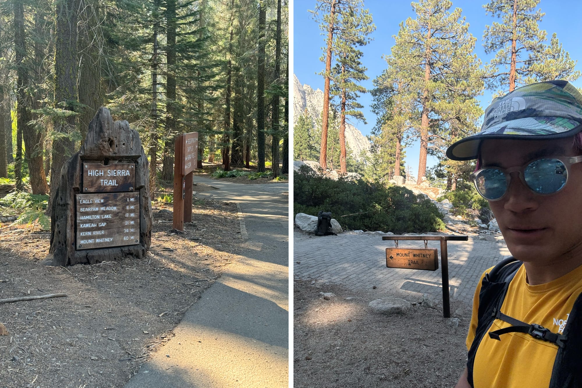
After finagling a last-minute Whitney permit and organizing a fairly expensive car shuttle – neither was easy nor guaranteed to be possible – it was a few days before the run, and I found myself suddenly quite nervous, now that I finally had the brain-space to consider what I signed myself up for. The High Sierra Trail traverses the Sierra across Sequoia National Park, the Kaweah range and Mt. Whitney in about 72 miles and, in the east-to-west direction I travelled, about 15,000ft of gain. There's no real way to bail out of it; all the "exits" are just as strenuous, far, or even harder and further, than just finishing the route. Or, you could reverse by heading back up and over Mt. Whitney. The only "easy" way out, really, is by helicopter...
A quick pep talk from Carling the night before calmed the nerves, and after a hot but manageable half day guiding Nutcracker, I headed out of Yosemite Monday afternoon on August 19th. As I drove into Sequoia National Park that night, the dusk light seemed a little too orange on the sequoias – fire smoke! It turns out there was a relatively small fire near Mineral King, cutely named the Coffee Pot fire, which I certainly didn't know about before. Immediately, I got really anxious... will it be smoky at the Lodgepole campground tonight? Was I going to wake up tomorrow morning with a terrible cough? How bad was the smoke on the trail?
Not much to do now but to bed down and see what the next day brings. The smoke didn't seem too bad overnight, and it was certainly hazy that morning at Crescent Meadow when I dropped off the car, packed, and got picked up. A lovely and efficient car shuttle by Trent of Three Rivers Transportation got us to Lone Pine and up the grade to Whitney Portal. It was a bluebird day on the Sierra Eastside, except for these little plumes wafting serenely over the Whitney crest... not moisture, but smoke. Somehow the smoke from that same Coffee Pot fire made it across the entire Sierra range. Again, it wasn't much, but I worried about what had settled in the deep river valleys between here and Crescent Meadow, valleys that I must run through. I was so anxious about it I seriously considered bailing, but it just seemed an awful letdown to not even try... and I reminded myself that these were all anxieties about the future, not something that is happening right now, in the present. I was breathing just fine, right now.
Still, there is no try on this trail... if I find a valley full of smoke half way in, I just gotta run through it.
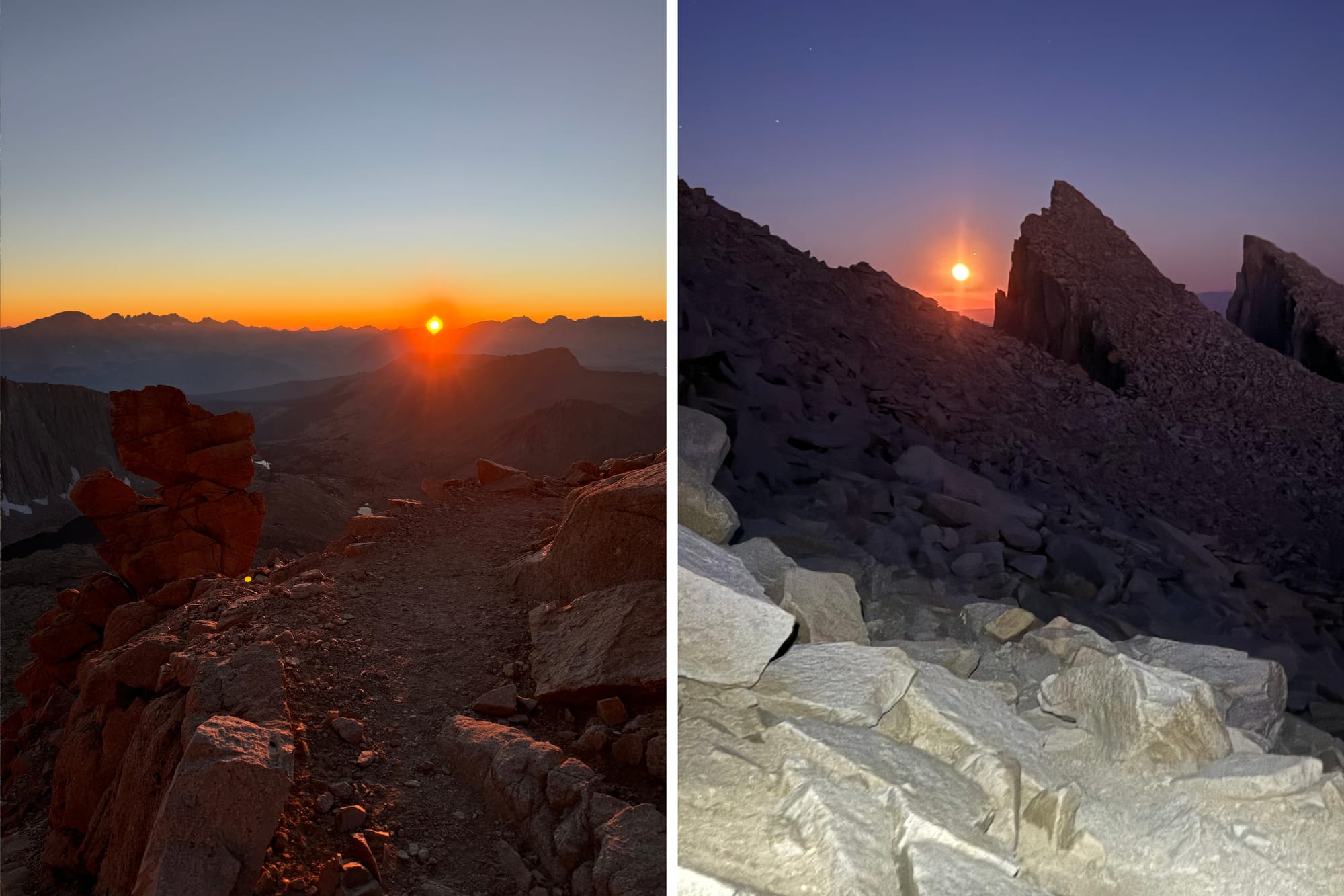
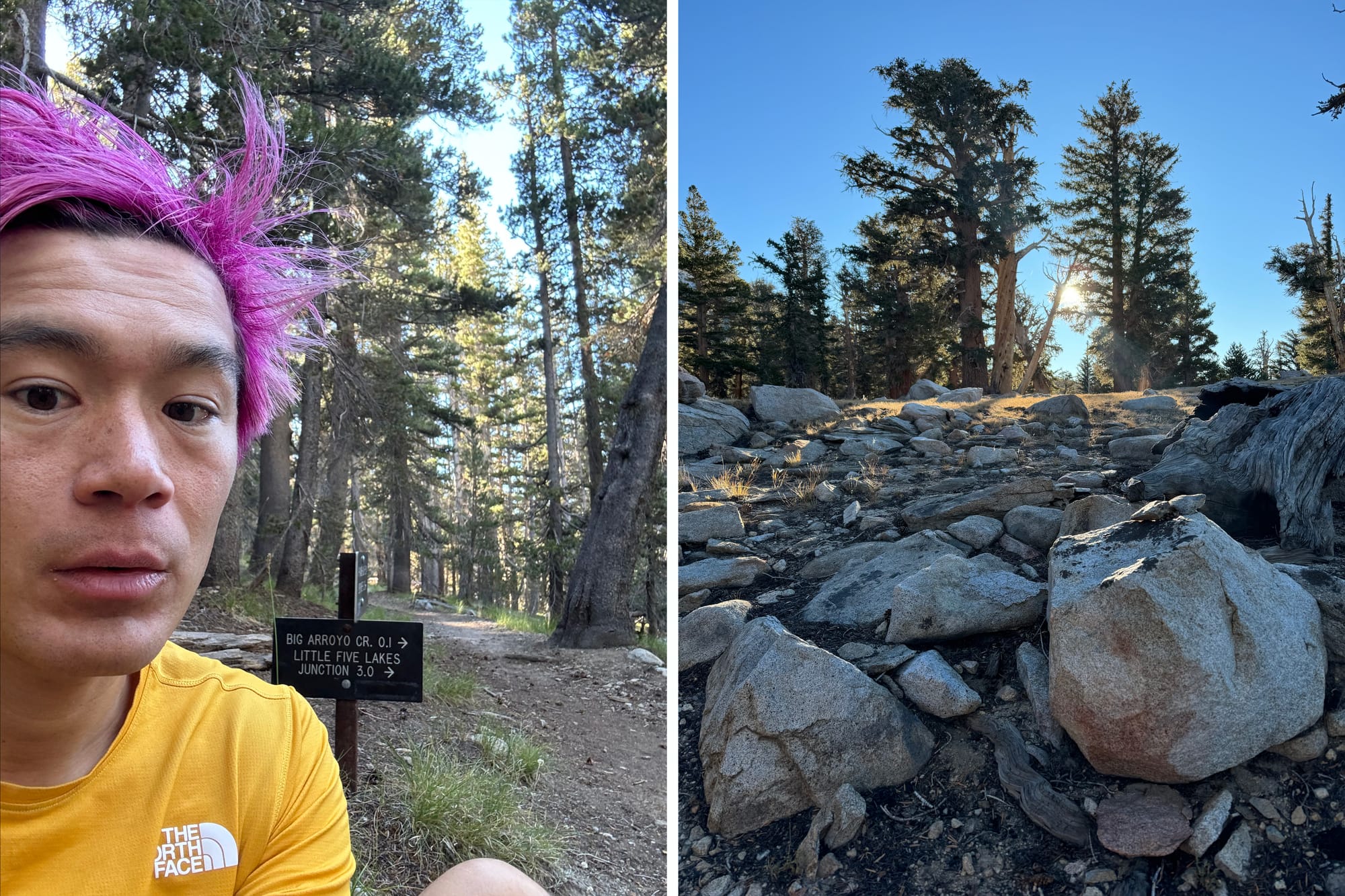
After just a tiny bit of milling around filling water and comically weighing my running pack on the scale at the start of the Mt. Whitney trail (12.5 pounds, including the 2L of water), I started just after 4pm. I felt GREAT on the first 5 or so miles (1h30m or so) up the trail, then I started bonking, hard. I realized that I had only eaten about 600 calories that day – the packing and the car shuttle was a bit all-consuming – so I ate way, way too little. I started scarfing a bunch of bars but the undernutrition certainly took the wind out of my sails a little. I felt a little dizzy up on Whitney crest (just from the altitude, I was fairly sure), and I pushed through, getting to the top just after sunset – beautiful, and completely alone on the summit! I then turned downhill, knowing that losing altitude will help with dizziness and with digestion, and that I'd feel better with every step.
I did indeed improve as I lost elevation, and had a cruiser several miles in the dark, whizzing by little lakes and the occasional glow-in-the-dark tabs of pitched tents. Sometime after getting back below treeline on the western side of Whitney, the sleep deprivation hit me really hard and I kept falling asleep while running/walking, stumbling all over the place and slowing way down. After resisting for an hour or so (unwisely, but the later you take caffeine, the longer you get its benefits), I eventually took some caffeine via ProBar bolts and immediately felt a lot better. I resumed a good pace and positive mental space, had a great time heading down into the upper Kern River canyon, and found a steady rhythm on that gently-downhill trail, a lot less scared of the night and potential lurking creatures than I had thought I would be. The occasional cluster of tents I passed helped, like a little buddy saying "hi!" I counted down the hours to sunrise: 6 hours to sunrise; 5 hours to sunrise.
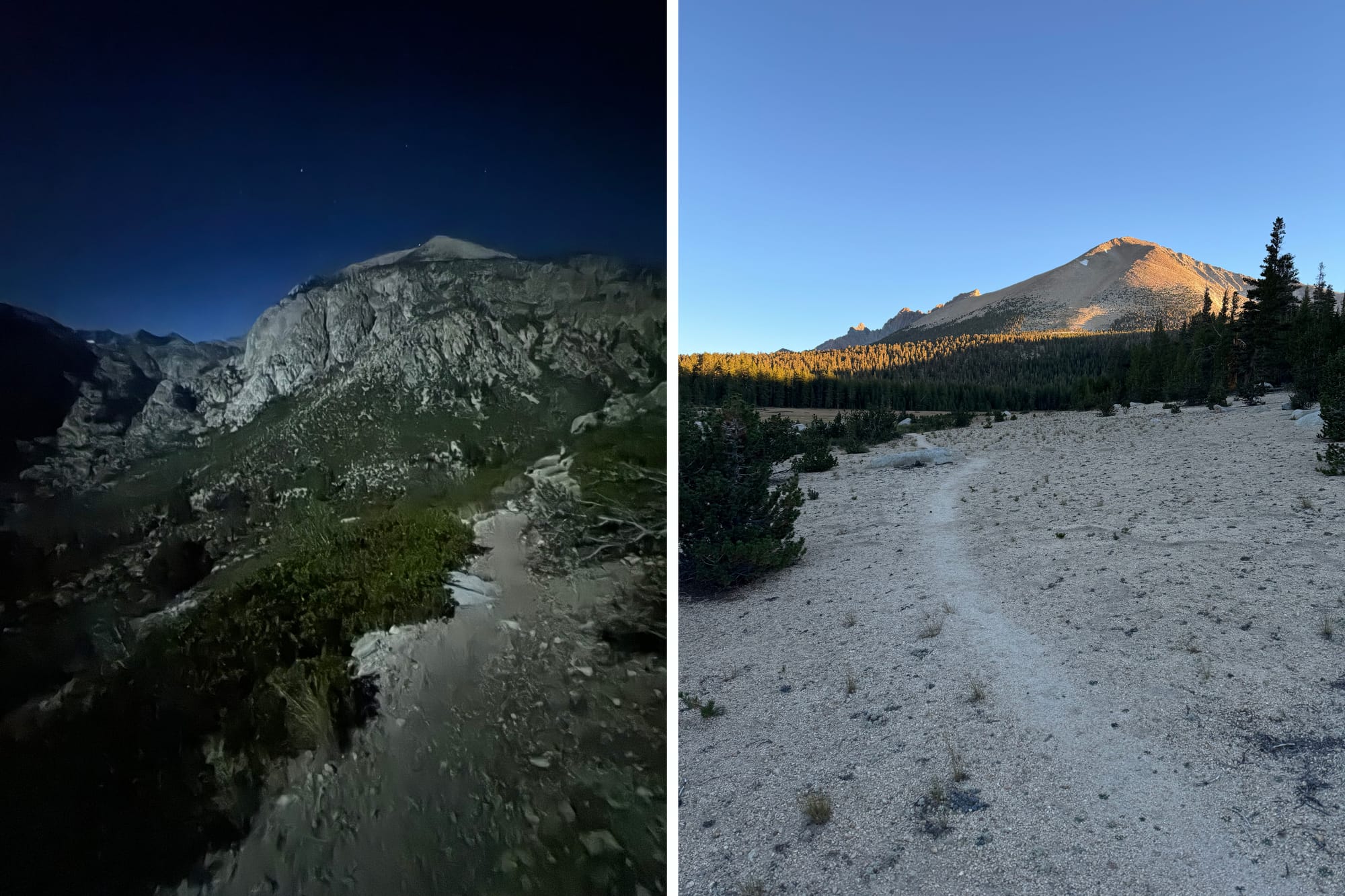
Eventually it was time to head uphill again, leaving the Kern River canyon and up towards the Kaweah crest. I filled water just a few switchbacks up from the trail junction; it was rough heading uphill again and I felt pretty tired, and the sleepiness was returning. I popped a few caffeine pills (Voke tabs – this time, a limited effect...) and held onto the hope that sunrise will help morale immensely. 3 hours to sunrise. 1.5 hours to sunrise. All of sudden, it brightened, and a new day dawned. That did help, but I still struggled to run anything not flat, and just kept prodding along the sparsely-treed canyon up towards the Kaweah Gap.
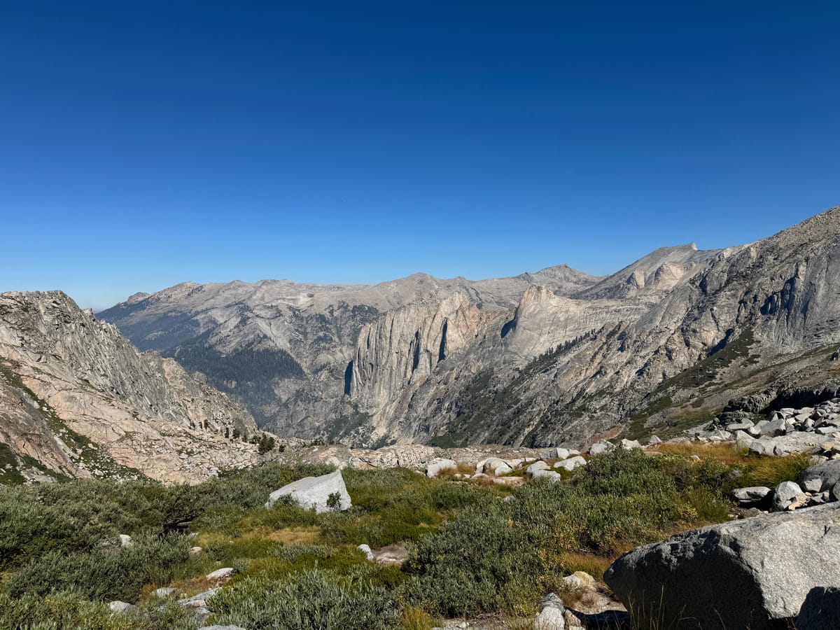
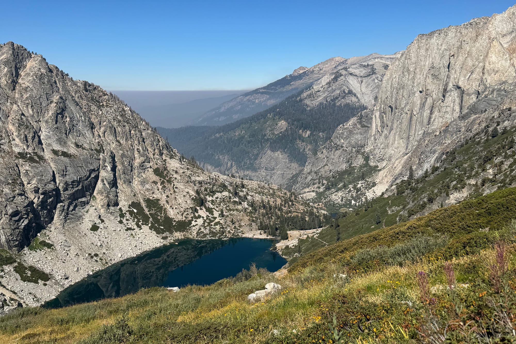
Now needing to take little breaks sitting in the shade here and there, I finally made it to the Gap. I was worried about what scene, in terms of smoke, might greet me over this final pass. Blissfully, it had been super clear overnight – I could tell it wasn't smoky at all by the color of the full moon in the sky, and I had been particularly anxious about smoke collecting overnight in the Kern River canyon. Now, looking over the Kaweah Gap, I was not so lucky; the canyon stretched out into a solid wall of grey smoke, the canyon walls eventually disappearing into the ugliness. I couldn't even see Moro Rock, which was only a handful of miles past where the car was parked.
It certainly didn't look great. Once again though, it wasn't smoky right now, and the pristine colors of the alpine I was surrounded by, in contrast to the smoke down valley, somehow lifted my spirits a little. Besides, I had no choice anyway. I got into a decent rhythm down through the Precipice Lake switchbacks, but the tricky, rock-littered path afterwards, created by literally blasting along the sheer rock face, felt unnatural and demotivating. It was hard to move with any consistent speed given the fatal fall consequences on my left side and the prodigious amount of loose rock and overgrown plant life.
As I crossed above the waterfall outlet of Big Hamilton Lake it gradually dawned on me that I had mentally prepared, somehow, for being pretty close to the end after the Kaweah Gap – but I actually still had a good 20 miles to go. Not close at all! – and it was going to be hot, it was going to be smoky, and I was devastatingly tired. I just wanted it to stop.
It wasn't pretty... I have always tried to keep my composure inside my own head – how you think is how you talk and how you act, after all – but I pretty much lost it. I hated every little bush growing over the trail, I hated every little uphill that appeared around the bend, I hated how unnatural and stupid I felt this trail was at that moment, and generally I was in an absolutely stinking mood. Sulking under my self-pitying black cloud, the compact Valhalla valley remained stunning in the haze. Angel Wings seemed like an untapped El Capitan worth of climbing, and it was magical indeed that this trail existed at all, hewn out of the side of the valley... how much work that must have been to build, and for the Park Service to maintain after every winter.
By the time I got to Bearpaw I gradually got a little more positivity back into my neurons, and managed to start running again with a little more consistency. Everything still felt terribly hard, and I daydreamed constantly about the car and the end. It did start feeling once again that I can control this situation, that I can do something about this – which is to keep running, keep moving, and no more self-pitying thoughts; those just make it harder to keep running... and if you stop moving, this will actually never, ever end.
Once past Eagle View – an incredible view of the headwater peaks (the Lippincott range?) of the Middle Fork of the Kaweah River behind me – I was but a mile away from the car. I locked in, brushing wordlessly past a group of tourists scattered on the trail, immobilized with phones in hand by some wildlife I was too focused to turn around and look for. In that final mile, a few gnats swarmed around me to add a final indignity, and then suddenly, I could see the roof of a car through the trees. It was done.
Thanks, as always, to the support from The North Face and Gnarly for these adventures!
Some stats:
- Tuesday, August 20th ~4pm to Wednesday, August 21st ~4pm
- 71.65mi, 15,331ft gain, in 23 hours and 27 minutes, by my watch
- 7.5 liters of water consumed
- 4,050 calories consumed (18 scoops of Gnarly Fuel2O, 6 bars, 1 waffle and 1 pack of gummies)
- 9,496 calories burned, according to Garmin's algorithm
- See more on the Strava activity